Top stories in Nova Scotia

Brewing up winners: Another big win lottery ticket sold at Cape Breton convenience store
Updated 4 hours ago
|3 min read

Two recent deaths near Portapique still not explained: ‘I know I keep my door locked’
Updated 19 hours ago
|5 min read

Police release name of Halifax homicide victim, 16; suspects still at large
Updated 18 hours ago
|3 min read
‘It’s worth saving’: Province invests $1.16 million into renovations at Mermaid Theatre in Windsor, N.S.
Updated 2 hours ago
|5 min read
Local
More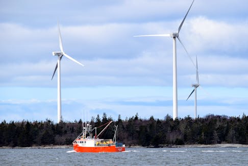
Two recent deaths near Portapique still not explained: ‘I know I keep my door locked’
Updated 19 hours ago
|5 min read
Province invests in West Hants, N.S., water upgrades amid ‘unprecedented growth’
Updated 19 hours ago
|5 min read

Former Truro police officer pleads guilty to voyeurism charges
Updated 21 hours ago
|2 min read
Southampton, N.S., man killed in Mapleton single-vehicle accident
Updated 23 hours ago
|1 min read
P.E.I. woman dead, Nova Scotia woman hospitalized following head-on collision in Upper Nappan
Updated 19 hours ago
|1 min read
Opinion
More
MARTHA MUZYCHKA: Rough sex is climbing among young people, and we need to talk about it
Updated 8 minutes ago
|5 min read

COMMENTARY: An ode to clover: So-called 'weed' has multifaceted benefits
Updated 1 hour ago
|4 min read

MICHAEL de ADDER CARTOON: Trump takes a swing
Updated 22 hours ago
|1 min read
COMMENTARY: Land acquisition critical to establishing Blue Mountain Park
Updated 21 hours ago
|5 min read
PETER McKENNA: Havana syndrome: Can Cuba be forgiven now?
Updated 17 hours ago
|5 min read
Business
More
Ottawa’s $60-million infusion to young entrepreneur program will help 6,250 businesses, Fraser says
Updated 20 hours ago
|3 min read

New Upper Canadian owners for two central Nova Scotia golf courses
Updated 18 hours ago
|3 min read

Workplace deaths trended down in Nova Scotia in 2023
Updated a day ago
|2 min read
Local job fair coming to the Rath Eastlink Community Centre in Truro, N.S.
Updated a day ago
|2 min read
HSBC says growing Chinese wealth fuels client investments in US
Updated 3 minutes ago
|2 min read
Lifestyles
More
Call to the hall: Cape Breton music industry recognizes 'undeniable' impact of Cameron, Fitzgerald, Foulds
Updated 31 minutes ago
|4 min read

JOAN SULLIVAN: Crisp and evocative writing in Donna Morrissey’s seventh novel, 'Rage the Night'
Updated 46 minutes ago
|5 min read

Cape Breton Community Calendar events for April 25-May 1
Updated 2 hours ago
|8 min read
PHOTO: Cape Breton Golden K gives to palliative care
Updated 2 hours ago
|2 min read
Sports
More
Atlantic All-Star event in Halifax will showcase the region's top female basketball players
Updated 23 hours ago
|4 min read

50th edition of Skate Canada International coming to Halifax in October
Updated 17 hours ago
|1 min read

NLL: Thunderbirds playoff ready? Record crowd watches Halifax defeat Colorado in regular-season finale
Updated Apr. 21, 2024
|5 min read
CEBL's Calgary Surge install St. F.X. bench boss Tyrell Vernon as new head coach
Updated Apr. 21, 2024
|4 min read
Wanderers fall 2-0 to Vancouver FC, lose second straight to start CPL season in B.C.
Updated Apr. 19, 2024
|5 min read
Communities
More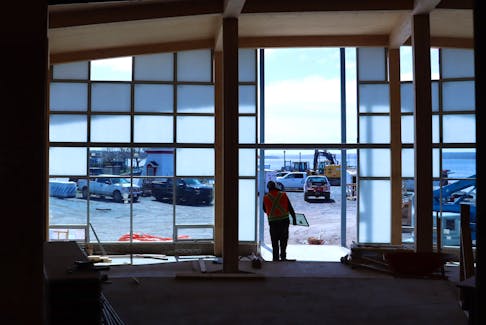
WENDY ELLIOTT: Music Festival Week brings joy, promotes learning to Wolfville, N.S.
Updated 2 hours ago
|5 min read

‘It’s worth saving’: Province invests $1.16 million into renovations at Mermaid Theatre in Windsor, N.S.
Updated 2 hours ago
|5 min read

Two recent deaths near Portapique still not explained: ‘I know I keep my door locked’
Updated 19 hours ago
|5 min read
Province invests in West Hants, N.S., water upgrades amid ‘unprecedented growth’
Updated 19 hours ago
|5 min read
Five Corners Properties talk 3,000 unit housing project in Bible Hill
Updated 19 hours ago
|5 min read
Canada
More
Cleantech data collection underway in Georgetown, P.E.I.
Updated 30 minutes ago
|2 min read

Canada retail sales miss expectations with second monthly fall
Updated 3 minutes ago
|2 min read

Edmunston net debt down $8.4M thanks to slight operational surpluses in 2023
Updated 50 minutes ago
|2 min read
Fredericton police investigating several shots fired, burned vehicle incidents
Updated 1 hour ago
|2 min read
New Brunswick's Horizon Health appoints Margaret Melanson as new president and CEO
Updated 2 hours ago
|2 min read
World
More
Wildfire razes pinelands near top Cuba tourist town of Viñales
HAVANA (Reuters) - A wildfire blazed early on Wednesday outside the picturesque western Cuba valley town of Vinales, state-run media said, threatening a region considered to be among the island's most important tourist destinations. Local media ...
Updated 14 minutes ago
|1 min read
Biden pardons 11 people, commutes sentences of five others, says White House
Updated 15 minutes ago
|1 min read

Columbia extends protest deadline after students agree to dismantle some tents
Updated 16 minutes ago
|3 min read

Germany charges six suspected ISIS-K members over attack plots
Updated 4 minutes ago
|1 min read
France's DGAC warns of cancelled flights at French airports due to strike
Updated 4 minutes ago
|1 min read
Turkish minister warns pro-Kurdish party it could face moves to ban it
Updated 1 hour ago
|2 min read
Recent Stories

First Quantum says probability of taking out copper from Panama mine only after election
Updated 3 minutes ago
|1 min read

Exclusive-Russian ministry stress scenario has growth stalling, rouble diving, document shows
Updated 6 minutes ago
|4 min read
COMMENTARY: Social media companies and parents must help tech-addicted children
Updated 8 minutes ago
|8 min read
MARTHA MUZYCHKA: Rough sex is climbing among young people, and we need to talk about it
Updated 8 minutes ago
|5 min read